5/11/2026 3:28 PM
(Washington, D.C.) — The Pacific Marine and Estuarine Fish Habitat Partnership (PMEP) has launched a new interactive ArcGIS StoryMap highlighting how PMEP’s habitat assessments, mapping tools, and data products can inform effective estuary restoration efforts that benefit fish, wildlife, and coastal communities. The StoryMap spotlights the Yaquina estuary to tell the story of estuary importance, shifting human values, and restoration effectiveness as it explores the use of PMEP resources.
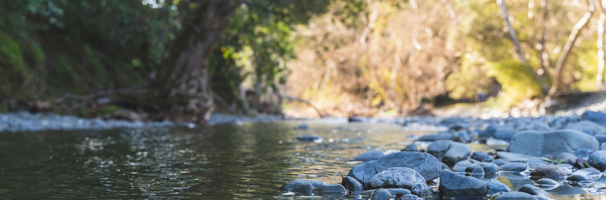
Located where the Yaquina River meets the Pacific Ocean at Newport, Oregon, the Yaquina estuary is a dynamic and productive ecosystem surrounded by agriculture, residential communities, industry, and natural areas. The estuary’s story is one of restoration and renewed understanding — highlighting the growing recognition of the ecological, cultural, and economic value estuaries provide to people and wildlife alike.
“Estuaries are some of the most important habitats for juvenile fish along the West Coast,” said Joan Drinkwin, PMEP Coordinator. “This StoryMap demonstrates how collaborative partnerships, science, and restoration planning are helping restore these ecosystems and improve habitat resilience for future generations.”
A Critical Nursery for Fish and Wildlife
The Yaquina Estuary is classified as a riverine estuary, where freshwater from rivers mixes with ocean saltwater to create highly productive habitats characterized by changing salinity, strong currents, nutrient recycling, and sediment trapping.Its eelgrass beds, tidal marshes, scrub-shrub habitats, and forested wetlands provide critical refuge, feeding, and nursery habitat for numerous fish and invertebrate species before they migrate into the open ocean.
PMEP’s StoryMap highlights how estuaries like Yaquina Bay were used by indigenous groups and how estuaries also support juvenile fish and crustaceans during critical life stages. The importance of estuaries are showcased in PMEP’s report: “Nursery Functions of West Coast Estuaries: Data Assessment for Juveniles of 15 Focal Fish and Crustacean Species.” The StoryMap explains and illustrates through interactive maps the degree to which estuary habitats have been lost over time from human alteration and also highlights the importance of tidal forested wetlands (aka swamps) and considerations for restoring these vital habitats.
Science-Driven Restoration and Regional Collaboration
In the Yaquina estuary, PMEP’s work is strengthened through collaboration with the MidCoast Watersheds Council (MCWC), a key partner in the Oregon Watershed Enhancement Board Focused Investment Partnership program. MCWC’s community-based approach supports large-scale restoration efforts focused on improving estuarine habitats, supporting fisheries resources, strengthening climate resilience, and protecting the ecological integrity of Oregon’s central coast watersheds. MCWC has used PMEP’s habitat assessments, data products, mapping resources, and collaborative guidance to inform its estuary restoration efforts. The StoryMap demonstrates how collaborative conservation efforts among scientists, local organizations, agencies, restoration practitioners, and community stakeholders can improve restoration outcomes while supporting local economies, recreation, and cultural values.
The release of this StoryMap comes as PMEP and its partners join the broader National Fish Habitat Partnership network in marking the 20th anniversary of NFHP in 2026—celebrating two decades of collaborative, locally driven conservation across the United States.
Looking Ahead
As estuaries continue to face pressures from habitat loss, development, and climate change, PMEP and its partners will continue advancing science-based restoration and conservation efforts designed to improve habitat connectivity and ecosystem resilience across the West Coast.
Future priorities include:
• Expanding estuary restoration and habitat reconnection projects
• Enhancing habitat assessments and mapping tools
• Supporting climate adaptation and resilience planning
• Strengthening community partnerships and stakeholder engagement
• Advancing science-based conservation strategies for West Coast estuaries
Explore the StoryMap
https://storymaps.arcgis.com/stories/30d4cb4c4f024339b5c4c70dffb5cb59
About the Pacific Marine and Estuarine Fish Habitat Partnership
The Pacific Marine and Estuarine Fish Habitat Partnership works to protect, restore, and enhance estuarine and nearshore marine habitats along the U.S. West Coast. As a recognized partnership under the National Fish Habitat Partnership, PMEP supports collaborative, science-based conservation efforts that improve habitat for fish and aquatic species while strengthening the resilience of coastal ecosystems and communities.
About the National Fish Habitat Partnership
Since 2006, NFHP has supported over 1,700 projects and invested more than $600 million in on-the-ground efforts that benefit fish habitat across all 50 states. NFHP leverages federal, state, Tribal, and private funding to support high priority conservation projects among 20 regional Fish Habitat Partnerships. In 2020, NFHP was formally recognized by Congress through the America’s Conservation Enhancement (ACE) Act and was reauthorized in 2024. NFHP guidance and policies are developed in conjunction with our partnerships and National Fish Habitat Board. For more information, visit fishhabitat.org.